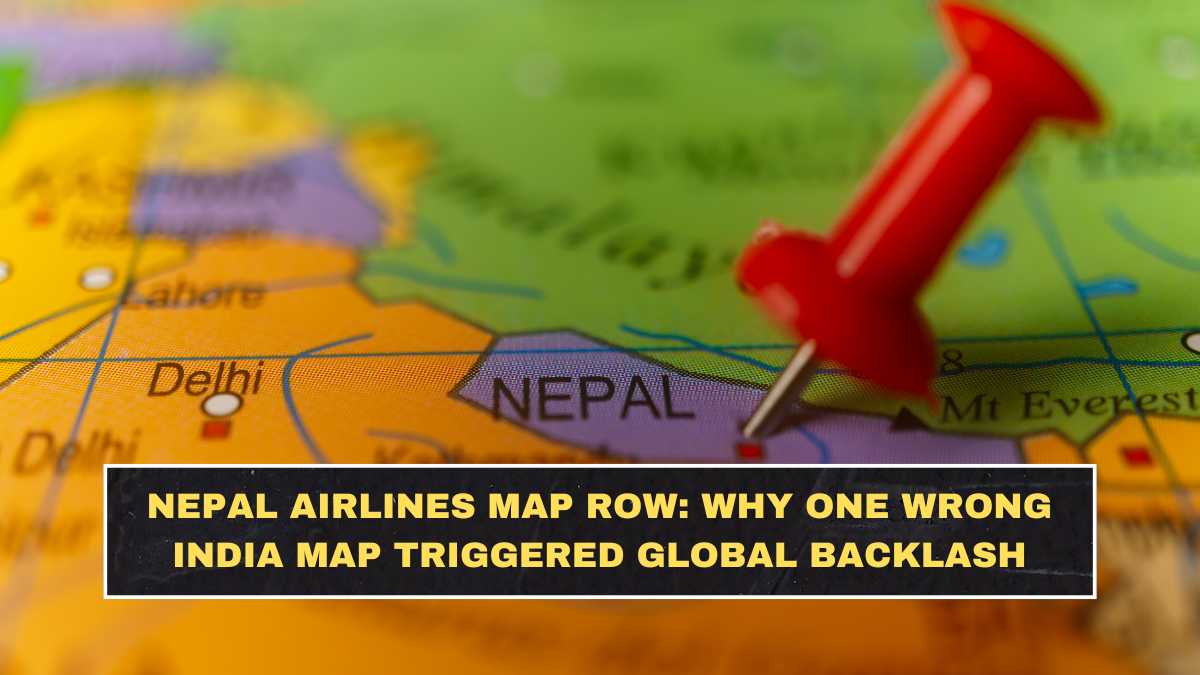
Nepal Airlines came under heavy criticism after a social media post reportedly showed Jammu and Kashmir as part of Pakistan in the airline’s “network map.” The post triggered quick backlash from Indian users, who accused the airline of sharing an incorrect and politically sensitive map of India. Within hours, the issue moved from a normal airline post to a diplomatic-style controversy.
The state-run carrier later deleted the post and issued a public apology. Nepal Airlines said the map contained “significant cartographic inaccuracies” regarding international boundaries and added that it did not reflect the official position of Nepal or the airline. The company also said it was conducting an internal review to prevent similar errors in future.

Why Did One Map Create Such A Big Backlash?
For many countries, maps are not just design elements. They represent sovereignty, territorial claims and national identity. In India, Jammu and Kashmir is an especially sensitive issue because Pakistan has historically claimed parts of the region, while India considers Jammu and Kashmir and Ladakh integral parts of the country.
That is why a wrong map does not feel like a harmless graphic mistake to Indian users. It is seen as a political statement, even when the organisation later calls it an error. This is the blind spot brands and public bodies keep repeating: they treat maps as decorative images, while users treat them as national symbols.
What Did Nepal Airlines Say In Its Apology?
Nepal Airlines said it sincerely apologised for the error in the network map shared on its social media channels. The airline described the issue as a cartographic inaccuracy and said the incorrect boundaries did not reflect the official stance of Nepal or Nepal Airlines. That clarification was important because the airline is state-owned, making the controversy more sensitive than it would be for a private travel page.
The airline also confirmed that the post had been removed immediately and that an internal review was underway. Indian Express reported that the apology came after the post was deleted amid growing backlash, while NDTV noted that the airline said it would ensure future materials meet higher accuracy standards.
| Issue | What Happened | Why It Matters |
|---|---|---|
| Organisation involved | Nepal Airlines | State-owned carrier, so the error looked more serious |
| Content type | Network map | Maps carry political and territorial meaning |
| Main mistake | J&K shown incorrectly | Directly touches India’s sovereignty concerns |
| Public reaction | Backlash from Indian users | Social media can escalate map errors quickly |
| Airline response | Post removed and apology issued | Damage control happened within 24 hours |
| Bigger lesson | Map accuracy matters | Brands cannot treat borders as casual design work |
Why Are Jammu And Kashmir Maps So Sensitive For India?
Jammu and Kashmir has long been one of the most sensitive territorial issues in South Asia. India’s official position is that the Union Territories of Jammu and Kashmir and Ladakh are part of India. Any foreign map or public communication that shows these areas differently is likely to be seen as challenging India’s territorial integrity.
The sensitivity became even stronger after India reorganised the former state of Jammu and Kashmir in 2019 into two Union Territories. Since then, India has repeatedly objected to foreign maps, platforms and organisations that display the region incorrectly. So when an airline from a neighbouring country shared such a map, the reaction was predictable, not surprising.
Why Does Nepal’s Role Make This More Complicated?
This controversy becomes more complicated because India and Nepal share deep cultural, economic and people-to-people ties, but their relationship has also seen map-related tensions before. Nepal’s own revised map issue involving Kalapani, Lipulekh and Limpiyadhura had already created friction with India in the past. That background makes any new map error more explosive.
Even if Nepal Airlines did not intend to make a political statement, the timing and history make Indians more alert to such mistakes. A state-linked carrier cannot afford casual cartographic errors because people do not read them in isolation. They connect them to older disputes, political narratives and regional sensitivities.
Why Do Map Mistakes Keep Happening Online?
Map mistakes happen because many organisations use stock visuals, third-party templates or poorly checked design files. A social media team may focus on routes, colours and layout while ignoring international boundary accuracy. That may sound like a small operational mistake, but for official brands, it is a major failure of review.
The harsh truth is that this is not a design problem; it is a governance problem. Any organisation posting country maps needs a strict approval process. If airlines, embassies, tourism boards or global brands use maps casually, they are inviting backlash. In sensitive regions, one wrong border can destroy the entire message.
Could This Affect Nepal Airlines’ Image In India?
The immediate damage is reputational. Indian users may see the airline as careless or insensitive, especially because the error involved Jammu and Kashmir. Even if the apology reduces the controversy, screenshots of the original post can continue to circulate, keeping the issue alive on social media.
For an airline, trust is not only about flights and fares. It is also about professionalism, accuracy and respect for countries it serves or communicates with. Nepal Airlines handled the issue by deleting the post and apologising, but the real test is whether it improves its internal review process. A second similar mistake would not be treated kindly.
What Should Brands Learn From This Controversy?
Brands need to understand that maps are high-risk content. Every map involving international boundaries should be checked against official sources before publication. This is especially important for South Asia, where borders involving India, Pakistan, China and Nepal carry strong political meaning.
Social media teams also need better escalation systems. A designer should not be the final authority on international borders. Legal, policy or senior communications teams should review sensitive geopolitical visuals before they go live. That may sound slow, but it is much faster than managing a public controversy later.
Conclusion?
The Nepal Airlines map row shows how quickly a visual mistake can become a political flashpoint. The airline called it a cartographic error, removed the post and apologised, but the backlash proves that maps are never neutral when borders are disputed or politically sensitive.
For India, Jammu and Kashmir is not a casual graphic detail. For brands, airlines and public institutions, the lesson is obvious: check maps before posting them. In today’s digital environment, one wrong boundary can travel faster than any official clarification.
FAQs
Why Did Nepal Airlines Apologise?
Nepal Airlines apologised after a network map shared on its social media channels showed Jammu and Kashmir incorrectly. The airline said the map contained significant cartographic inaccuracies and did not reflect the official position of Nepal or Nepal Airlines.
What Was Wrong With The Nepal Airlines Map?
Reports said the map showed Jammu and Kashmir as part of Pakistan. This triggered backlash from Indian users because India considers Jammu and Kashmir and Ladakh integral parts of the country.
Did Nepal Airlines Delete The Post?
Yes, Nepal Airlines deleted the controversial social media post after the backlash. The airline also said it was conducting an internal review to prevent such mistakes from happening again.
Why Are Incorrect India Maps Controversial?
Incorrect India maps are controversial because they can appear to challenge India’s territorial claims and sovereignty. Regions like Jammu and Kashmir are especially sensitive, so wrong depictions can quickly become political and diplomatic issues.